
Did you like it? Do share this post, leave a comment below, and send me a gift! (opens in a new tab/window)
Updated bike lane maps and where to find them
Community-driven and frequently updated Bicycle Maps for the Philippines

Are you from or is planning to visit the Philippines? The Philippines Department of Transportation (DOTr) recently asked Google to include bike lanes in Google Maps, which was a very good move as the country is learning to live with biking as a mode of transportation instead of only as a form of exercise and sports. But why wait when there are already existing and updated maps for bike lanes in the Philippines?
What is OpenStreetMap
OpenStreetMap, or OSM, is a very successful community-driven and updated geographic database of the world. Anyone can contribute to improve OSM and because of its open database nature, other projects can also use its geographical data to create specialized maps. One such is CyclOSM, a cycling/biking-oriented map.
What is CyclOSM?
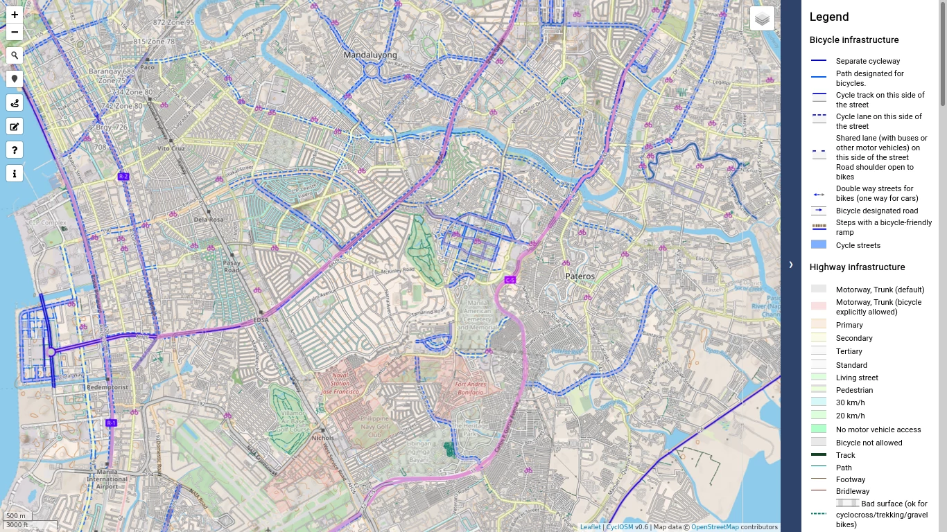
CyclOSM is a bicycle-oriented map built on top of OpenStreetMap data. It aims at providing a beautiful and practical map for cyclists, no matter their cycling habits or abilities.1
In urban areas, it renders the main different types of cycle tracks and lanes, on each side of the road, for helping cyclists draw their bike to work routes. It also features essential POIs as well as bicycle parking spots or spots shared with motorbikes, specific infrastructure (like elevators and ramps), road speeds, or surfaces to avoid streets with pavings, bumpers, and bike boxes, etc.1
See the Legend or View Larger Map on CyclOSM
Availability
CyclOSM is available in these smartphone apps:
- OSMAnd: Android; Amazon; iOS; Huawei
- All-In-One Offline Maps: Android
- AlpineQuest Rando GPS: Android (Lite); Android (Full version)
- OpenMultiMaps: Android via F-Droid
Bike Lanes via Google My Maps
Started by: Jesus Israel Jr.; View Larger Map